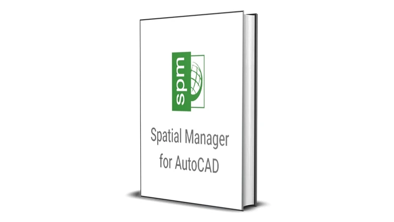
Spatial Manager Desktop [Lifetime] for Windows
$49.99 – $79.99
⌛ Limited Promotion! Prices may go back up!
🎁 FREE DELIVERY to your email from 5 mins to 6 hours

Spatial Manager Desktop [Lifetime] for Windows
$49.99 – $79.99Request a Call Back
- Read First
Size Guide

ALL PRODUCTS IN DIGITAL FORMAT
🌻 In the form of a link that you have to download🌻 Not getting a Physical Product (CD or Flashdisk)🌻 Don't worry about Damage because Files are always Protected🌻 Safe from Viruses and Malware (always Scanned)🌻 Received on the same day very fast🌻 Free Shipping (Includes Tax & Fee)🌻 Instant and Fast received🌻 No need to wait for the Courier for days🌻 Can be downloaded repeatedly🌻 The locked link can only be accessed by the Buyer's Email🌻 Cannot be shared with other people (Other Email)
ABOUT PRODUCT SHIPPING
🌷 Products are sent via Email🌷 There is no physical delivery in any form🌷 Free Shipping to ALL COUNTRIES IN THE WORLD🌷 Even buying 1 product is still free shipping (no minimum purchase)🌷 Faster, easier and simpler🌷 Please include your email in the notes when purchasing🌷 The email contains a product link that is ready for you to download🌷 Only accessible by Buyer Email🌷 Cannot be shared or accessed by other e-mails🌷 One click, the file will be downloaded immediately
HOW TO USE THE PRODUCT
🌹 Open Email to access your Order🌹 Click the link to start downloading the file🌹 After downloading, open File🌹 Follow the Guide that is in it🌹 Each product is equipped with How to Use🌹 Guide in English, use Translate (Google)🌹 Don't worry especially for Beginners because it's Easy🌹 If confused you can CONTACT US🌹 We will give instructions to you until the product is successfully used🌹 100% money back guarantee if the product cannot be used🌹 With Terms and Conditions that apply
HOW TO CLAIM BONUS
🍀 Every Buyer is entitled to a Bonus🍀 You can check in Email and My Account🍀 You can also CALL US to ask for Bonuses🍀 Follow the Terms and Conditions to get the Bonus🍀 The bonus is forfeited in violation of the Terms - Warranty & Return
Warranty and Returns

ABOUT WARRANTY
👑 Buyers are protected by Paypal Security👑 Products are guaranteed for 7 days👑 If there is any issue, Buyers can Contact Us👑 Provide the Invoice or other Proof of Purchase👑 Include Proof in the form of Photos or Videos👑 Tell us about the problem that occurred with the purchased Product👑 We will assist until the issue is resolved👑 If necessary, Team Viewer will be used👑 Guaranteed replacement of similar products👑 Money-back guarantee if the product is unusable👑 Eligible for a refund
CONDITIONS FOR REQUESTING A REFUND
♻️ Complaints must be made within 7 days of receiving the product♻️ Complaints received after 7 days will not be accepted♻️ Provide at least 1 proof (can be a photo, image, or video)♻️ Have followed the instructions provided but the product still cannot be used♻️ Used Team Viewer but our team cannot solve the problem
SOLUTIONS OFFERED
👍 Provided with instructions until Team Viewer is performed👍 Replacement with similar product (Different File)👍 Exchange with other products👍 100% Money Back Guarantee without Deduction - Ask a Question

Spatial Manager Desktop [Lifetime] for Windows
$49.99 – $79.99Ask a Question
Information about Spatial Manager Desktop
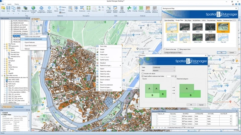
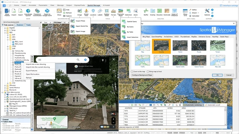
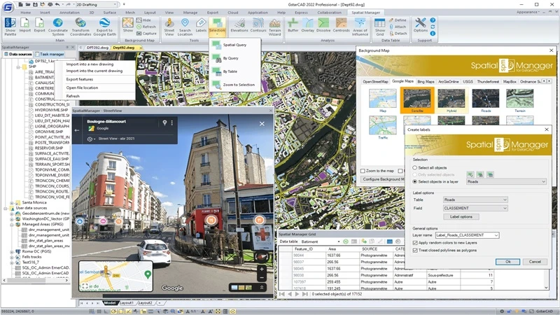
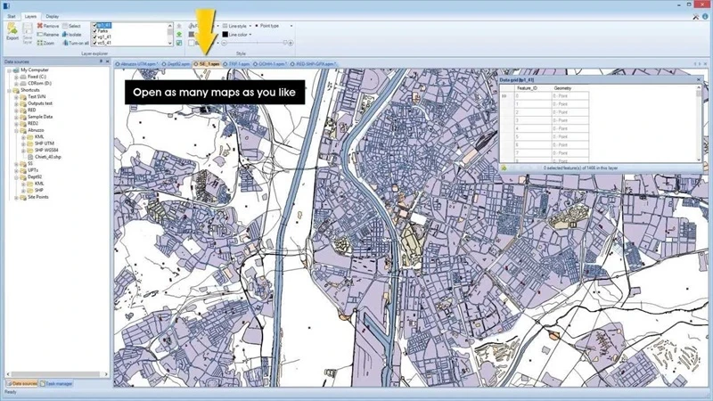
Spatial Manager Desktop is a highly powerful tool, designed specifically for handling spatial information in planning and infrastructure projects. It has a very wide range of functionality that makes it perfectly suitable for large infrastructural projects to small tasks in planning. It allows access to working with data in different file formats, without compatibility problems. Import and export tasks can be automated, saving the time involved and reducing manual input. It is powerfully put into use while also meeting spatial data management’s very demands. It offers a neatly structured and practical GUI accessible to all skill levels. Its tabbed interface allows you to switch between sections effortlessly, enhancing your workflow efficiency.
Spatial Manager Desktop provides an easy interface through which one can easily operate spatial data management for novices. It makes the creation and printing of maps easy and thus allows users to effectively capture spatial information. It provides a wide scope of reading and writing of spatial data in various formats and servers. Moreover, it directly publishes spatial data to Google Earth, thereby increasing accessibility and options in sharing data. This can increase flexibility when handling spatial data by converting geometry between CRSs. The program’s main window displays your workspace, where your map is presented. Side panels provide access to ‘Data Sources’ and the ‘Data Grid,’ along with additional details about a selected ‘Feature.’
Features and Overview of Spatial Manager Desktop
- Used for managing spatial information in a planning and infrastructure project
- System can be used on big infrastructural sizes down to small planning ones
- Import and export data regardless of format without compatibility problems
- Saves time through automating the import and export processes while minimizing manual inputs
- Allows for easy usability even for first-time users to manage their spatial data
- Allows producing and printing maps which facilitate the effective capture of spatial information.
- Direct output from the spatial data to Google Earth for wider availability and usability.
- Conversions in between geometric objects among various other CRS.
- Read and Write Spatial Data: It supports many file formats and servers, allowing you to read and write spatial data effortlessly.
- Coordinates Transformation: You can calculate geometric transformations of features during the import and export processes, ensuring accuracy in your spatial data.
- Background Maps: Choose from dynamic background maps from providers like Google Maps, OpenStreetMap, Bing, MapBox, and Ordnance Survey, or configure your maps from TMS, WMS, or WMTS servers.
- Publishing to Google Earth: Export elements in visible layers of your map and their data to KML or KMZ files, making it easy to share your spatial data.
- Layer Management: Arrange your maps into layers the application can fully manage, enhancing organization and clarity.
- Data Query and Edition: Manage alphanumeric data attached to elements, design data structures, and edit them according to your project’s needs.
- Fields Calculator: You can calculate simple or complex expressions using operators and functions applied to field values in a table and constant values.
- Spatial Analysis: Perform spatial analysis operations on objects in your drawing or map, generating new objects based on your analysis.
- Location Tools: The software includes location and geo-coding tools that help you add reference elements and enhance data for existing objects.
- Task & Processes: The software can save tasks, simplifying repetitive import and export processes.
- Multilanguage Support: The software is available in English, German, Spanish, French, Russian, and Portuguese, making it accessible to a global user base.
System Requirements and Technical Details
- Operating System: Windows Vista/Windows 7/Windows 8/Windows 10/Windows 11
- Processor: 2.4 GHz
- Memory: 3-4 GB RAM
- DirectX: Version 10
- Storage: 9 GB available space
- Sound Card: DirectX compatible sound card
List of Available Spatial Manager Desktop Series
The following is a list of the Spatial Manager Desktop series available at the Phoenix3dart store:
- Spatial Manager Desktop 2022
- Spatial Manager Desktop 2023
- Spatial Manager Desktop 2024
- Spatial Manager Desktop 9.2.1
* See thousands of other products at Phoenix3dart Big Store ️️
Important to Know Before Purchase!
- This is a Digital item, no CD/DVD or physical package will be shipped
- Orders are sent via EMAIL, fast and FREE SHIPPING
- Easy installation with a provided guide
- Software is guaranteed to work 100% and can be played
- Full Activation (LIFETIME) – Not a Trial – Not a Demo
- Cannot be Updated
- Can be run Offline, anywhere, anytime
- Used on Windows devices (for macOS, please use BootCamp)

UPC: 279396110001251 | EAN: 9396110001251
| SELECT SERIES | Spatial Manager Desktop 2022, Spatial Manager Desktop 2023, Spatial Manager Desktop 2024, Spatial Manager Desktop 9.2.1 |
|---|
Reviews
There are no reviews yet.
- TOOLS
- SOFTWARE APPS
- MOVIES
- EBOOK
- Engineering
- Profession
- Fiction & Fantasy
- Religion & Spirituality
- Food and Drink
- Romance & Love
- Health & Medicine
- Science
- History & Lore
- Sport
- Arts & Entertainment
- Homes & Buildings
- Technology
- Biographies & Experiences
- Horror & Mystery
- Travel
- Business & Finance
- Manga Novels
- Young adult
- Delicious Cooking
- Marriage & Relationships
- Design
- Parenting
- Education
- Political
- HARDWARE
- GAMES
❤️️❤️️❤️️❤️️❤️️ RELATED PRODUCTS ❤️️❤️️❤️️❤️️❤️️
-
Paragon Hard Disk Manager Technician [Lifetime] for Windows
$79.99Original price was: $79.99.$29.99Current price is: $29.99.Add to cart⌛ Limited Promotion! Prices may go back up!
🎁 FREE DELIVERY to your email from 5 mins to 6 hours
-
Pixologic Zbrush [Lifetime] for Windows or macOS $19.99 – $79.99Select options
⌛ Limited Promotion! Prices may go back up!
🎁 FREE DELIVERY to your email from 5 mins to 6 hours
-
Paragon Migrate OS to SSD [Lifetime] for Windows
$29.99Original price was: $29.99.$14.99Current price is: $14.99.Add to cart⌛ Limited Promotion! Prices may go back up!
🎁 FREE DELIVERY to your email from 5 mins to 6 hours
-
IntraWeb Ultimate Edition [Lifetime] for Windows $9.99 – $29.99Select options
⌛ Limited Promotion! Prices may go back up!
🎁 FREE DELIVERY to your email from 5 mins to 6 hours
-
Paragon Drive Copy Professional [Lifetime] for Windows
$49.99Original price was: $49.99.$24.99Current price is: $24.99.Add to cart⌛ Limited Promotion! Prices may go back up!
🎁 FREE DELIVERY to your email from 5 mins to 6 hours
-
Acrobat Pro DC [Lifetime] for Windows or macOSRated 5.00 out of 5$14.99 – $49.99Select options
⌛ Limited Promotion! Prices may go back up!
🎁 FREE DELIVERY to your email from 5 mins to 6 hours

-
TunesKit Activation Unlocker [Lifetime] for Windows $14.99 – $29.99Select options
⌛ Limited Promotion! Prices may go back up!
🎁 FREE DELIVERY to your email from 5 mins to 6 hours
-
Adobe Acrobat Reader DC [Lifetime] for Windows or macOS $12.99 – $29.99Select options
⌛ Limited Promotion! Prices may go back up!
🎁 FREE DELIVERY to your email from 5 mins to 6 hours

-
Math Resource Studio Enterprise [Lifetime] for Windows $9.99 – $29.99Select options
⌛ Limited Promotion! Prices may go back up!
🎁 FREE DELIVERY to your email from 5 mins to 6 hours
-
Gillmeister Automatic PDF Processor [Lifetime] for Windows $24.99 – $49.99Select options
⌛ Limited Promotion! Prices may go back up!
🎁 FREE DELIVERY to your email from 5 mins to 6 hours

-
EasyUEFI Professional [Lifetime] for Windows $6.99 – $24.99Select options
⌛ Limited Promotion! Prices may go back up!
🎁 FREE DELIVERY to your email from 5 mins to 6 hours
-
ToolsToo Pro [Lifetime] for Windows $4.99 – $14.99Select options
⌛ Limited Promotion! Prices may go back up!
🎁 FREE DELIVERY to your email from 5 mins to 6 hours

-
Twinmotion [Lifetime] for Windows $19.99 – $59.99Select options
⌛ Limited Promotion! Prices may go back up!
🎁 FREE DELIVERY to your email from 5 mins to 6 hours
-
Secure Eraser Professional [Lifetime] for Windows $9.99 – $19.99Select options
⌛ Limited Promotion! Prices may go back up!
🎁 FREE DELIVERY to your email from 5 mins to 6 hours

-
Iperius Backup [Lifetime] for Windows $14.99 – $39.99Select options
⌛ Limited Promotion! Prices may go back up!
🎁 FREE DELIVERY to your email from 5 mins to 6 hours
-
MobiPdf [Lifetime] for Windows $24.99 – $34.99Select options
⌛ Limited Promotion! Prices may go back up!
🎁 FREE DELIVERY to your email from 5 mins to 6 hours

-
Retouch4me Skin Mask [Lifetime] for Windows
$89.99Original price was: $89.99.$39.99Current price is: $39.99.Add to cart⌛ Limited Promotion! Prices may go back up!
🎁 FREE DELIVERY to your email from 5 mins to 6 hours
-
MSC EASY5 [Lifetime] for Windows $29.99 – $39.99Select options
⌛ Limited Promotion! Prices may go back up!
🎁 FREE DELIVERY to your email from 5 mins to 6 hours

-
Retouch4me Portrait Volumes [Lifetime] for Windows $29.99 – $39.99Select options
⌛ Limited Promotion! Prices may go back up!
🎁 FREE DELIVERY to your email from 5 mins to 6 hours
-
WizTree Enterprise [Lifetime] for Windows $19.99 – $49.99Select options
⌛ Limited Promotion! Prices may go back up!
🎁 FREE DELIVERY to your email from 5 mins to 6 hours













Be the first to review “Spatial Manager Desktop [Lifetime] for Windows”